| |||
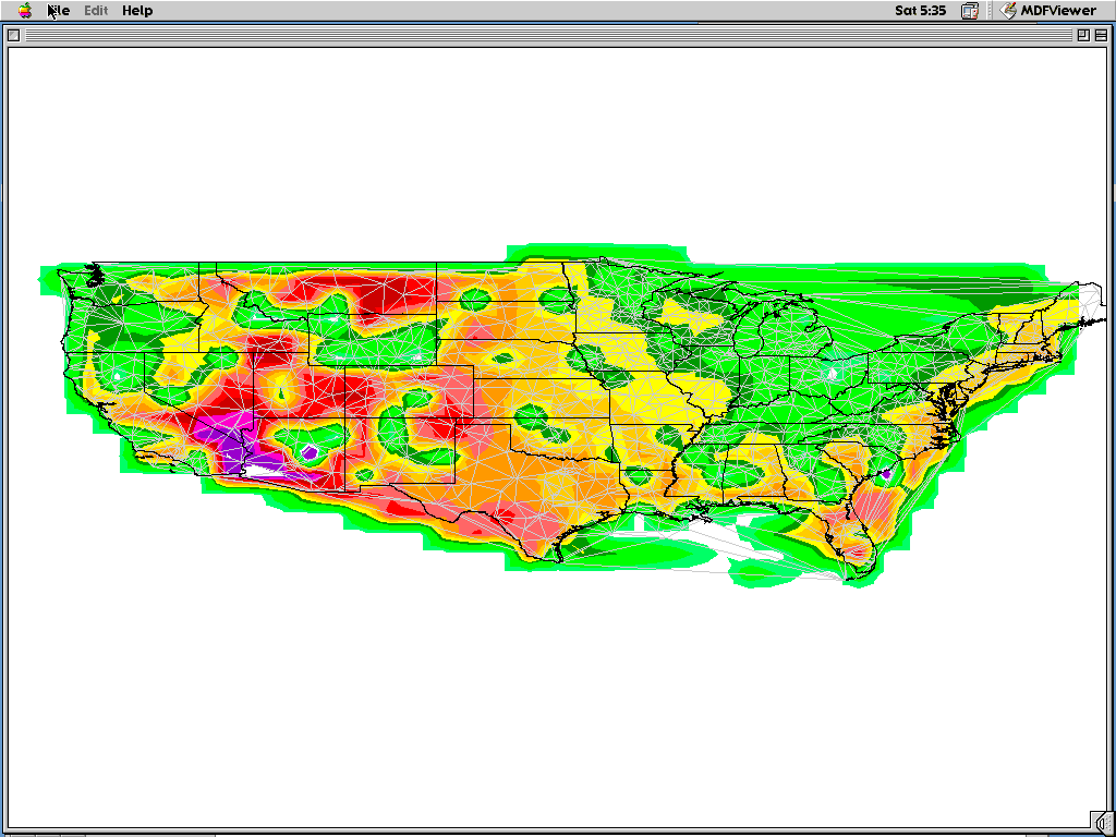
| Development of contour display. Using NWS sites for irregular grid, a triangular mesh was developed (light gray). Temperatures read from MDF files were used to interpolate values along this mesh resulting in colors plotted. Note this version is being run on a Macintosh. By implementing Win32 GDI under the MacOS enabled cross-compiled, source level compatibility with no performance hit to the Win32 version and extremely little to none for the Mac version. |
|